
In the map segment below (from the CAD map for Queensland Two Mile Series - 1952) the station locations for Loamside to Hillside are detailed.
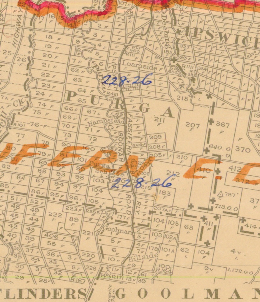
Segment from QLD 2 Mile map - 1952
Loamside railway station
Loamside was served by the Loamside railway station on the Ipswich Boonah Road. It was 5 miles 21 chains (8.5 km) from Ipswich at an elevation of 155 feet (47 m) [27.6711°S 152.7364°E].
The origin of the suburb Yamanto came from a former 50 acre (20 ha) 1860s cotton plantation which was originally spelt as 'Yamahanto', the property jointly owned by Queensland's first government medical officer Henry Challinor (1814–1882) and his cousin George Miles Challinor (1832–1888). Previous names used for this area were Mine Accident, Loamside and Yahmahnto. The name Loamside was given to the railway station in the Yamanto area on the now-defunct Dugandan railway line. [1]
During February of 1957, QR (Queensland Railway) were processing Batch No.9 Alteration of Station name "Loamside" Fassifern Branch to "Leamside". Ultimately the name remained as Loamside being descriptive of the "rich red soil in the area".
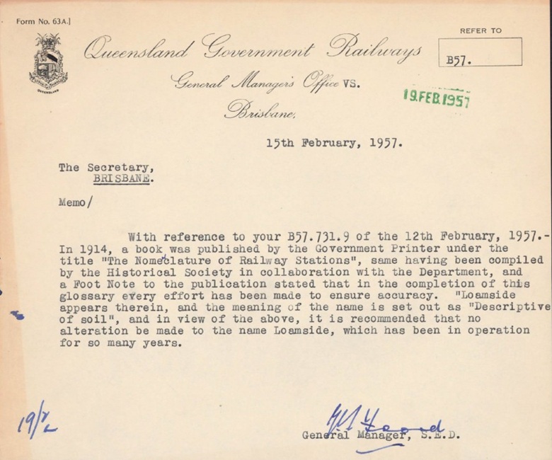
QR Batch No9 "Loamside" to "Leamside" [2]
Utilising Google Maps Lat/Long coordinate search, it places the Loamside railway station opposite the old service station along the Boonah-Ipswich Road, just passed the new Q Greyhound Racing Facility.
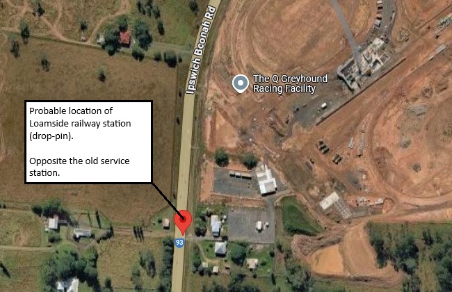
Probable Loamside railway station location
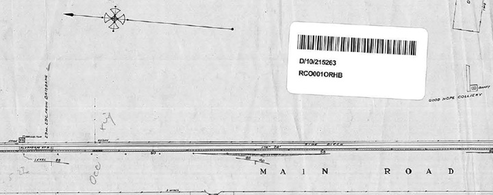
Loamside railway station layout 1922 (QR drawing) [3]
Queensland Railways - Fassifern Branch - Loamside Station (revised to June 1922)
Revision details from the Queensland Railways drawing as follows:
- 02-03-1964 - (W.N. 10/64) Closed to Public Traffic from 01-07-1964
Hampstead railway station
Hampstead was served by the Hampstead railway station on the Ipswich Boonah Road. It was 7 miles 71 chains (12.7 km) from Ipswich at an elevation of 118 feet (36 m) [27.69364°S 152.73846°E].
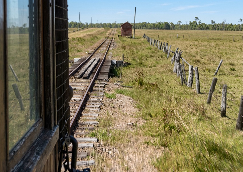
view near Hampstead railway station - Cream Shed at Fords Lane - 1960
Utilising Google Maps Lat/Long coordinate search, it places the Hampstead railway station opposite the Flinders Peak Medical Centre along the Boonah-Ipswich Road, just passed Hughes Road.
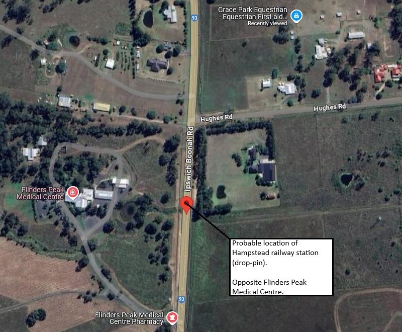
Probable Hampstead railway station location
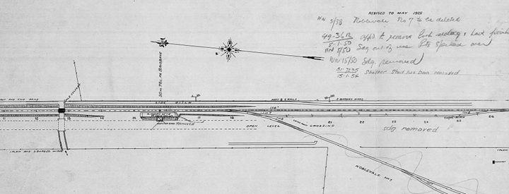
Hampstead railway station layout 1925 (QR drawing) [4]
Queensland Railways - Fassifern Branch - Hampstead Station (revised to May 1925)
Revision details from the Queensland Railways drawing as follows:
- 10-01-1938 - (W.N. 3/38) Noblevale No.7 to be deleted
- 05-01-1950 - (49-3612) Approved to remove loop siding and have points spiked over
- 30-01-1950 - (W.N. 5/50) Siding out of use, points spiked over
- 10-04-1950 - (W.N. 15/50) Siding removed
- 15-01-1954 - (51.7235) Shelter shed has been removed
- 02-03-1964 - (W.N. 10/64) Closed to Public Traffic from 01-07-1964
Purga railway station
Purga was served by the Purga railway station on the Ipswich Boonah Road. It was 8 miles 07 chains (13.0 km) from Ipswich at an elevation of 162 feet (49 m) [27.71008°S 152.73864°E].
Purga parish name was derived from the Aboriginal word "pur-pur", meaning a meeting place or "bora" ground. Purga was serviced by three stations: Loamside, Hampstead, and Purga railway stations.
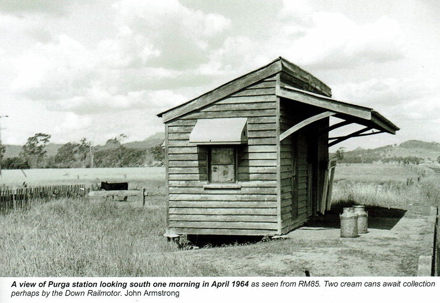
Purga railway station - 1964
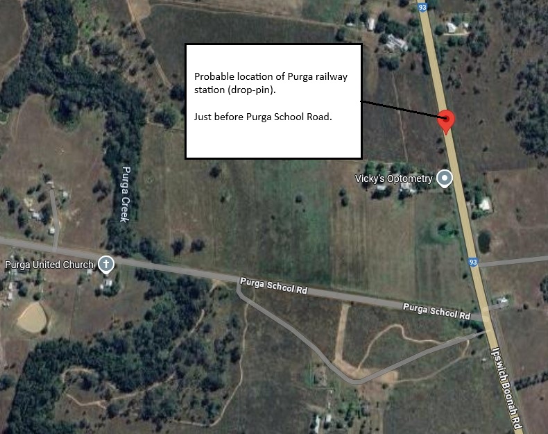
Probable Purga railway station location
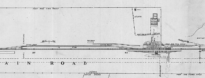
Purga railway station layout 1927 (QR drawing) [5]
Queensland Railways - Fassifern Branch - Purga Station (revised to June 1927)
Revision details from the Queensland Railways drawing as follows:
- 14-08-1950 - (49.4657) Approved to give the Station Master's a washtub
- 10-11-1953 - (51.7320) Cream shed removed and re-erected at No.5 stop 7m22c Fassifern
- 29-04-1954 - (W.N. 17/54) Purga now closed as a gate and worked as an isolated Siding
- 02-03-1964 - (W.N. 10/64) Closed to Public Traffic from 01-07-1964
Goolman railway station
Goolman was served by the Goolman railway station on the Ipswich Boonah Road. It was 9 miles 73 chains (16.0 km) from Ipswich at an elevation of 162 feet (49 m) [27.7365°S 152.7416°E].
The locality name Goolman comes from nearby Mount Goolman, which in turn derives its name from stone axe in the Yuggera language. Goolman was served by the Goolman railway station on the Ipswich Boonah Road.
Utilising Google Maps Lat/Long coordinate search, it places the Goolman railway station between Ellison and Bards Roads along the Boonah-Ipswich Road.
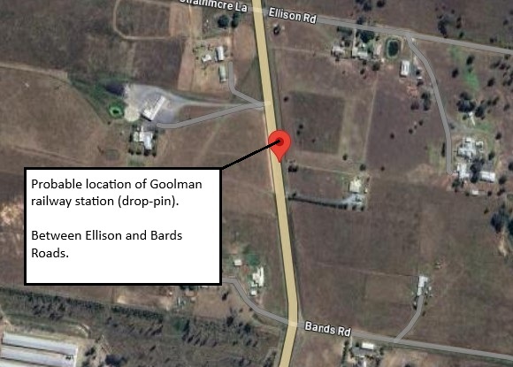
Probable Goolman railway station location
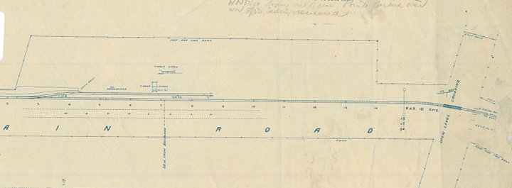
Goolman railway station layout 1922 (QR drawing) [7]
Queensland Railways - Fassifern Branch - Goolman Station (revised to June 1922)
Revision details from the Queensland Railways drawing as follows:
- 12-09-1949 - (W.N. 37/49) Siding out of use, points spiked over
- 20-02-1950 - (W.N. 8/50) Siding removed
- 02-03-1964 - (W.N. 10/64) Closed to Public Traffic from 01-07-1964
Hillside railway station
Hillside was served by the Hillside railway station on the Ipswich Boonah Road. It was 10 miles 67 chains (17.4 km) from Ipswich from Ipswich at an elevation of 154 feet (47 m) [27.7497°S 152.7367°E].
Utilising Google Maps Lat/Long coordinate search, it places the Hillside railway station at the intersection of Hillside and T Morrows Roads along the Boonah-Ipswich Road. It is also at the turn-off for the Purga Quarry, which has been in operation since 1990. It supplies materials for major projects in the surrounding area.
However, in the 1952 era map segment displayed above, has the Hillside railway station located just north of this intersection - just prior to T Morrows Road.
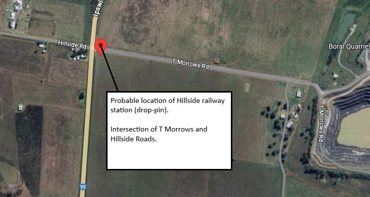
Probable Hillside railway station location
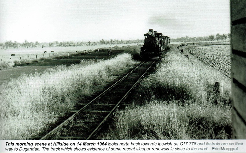
View from Hillside railway station - 1964 [8]

Hillside railway station layout [9]
- [1] Wikipedia - Yamanto Queensland
- [2] QR Batch No9 "Loamside" to "Leamside" - (view the full version)
- [3] S00973-0001 Loamside Station (June 1922) - (view the full version)
- [4] S00974-0001 Hampstead Station (May 1925) - (view the full version)
- [5] Look Out for Train: 7 - To The Scenic Rim 1 (page 26)
- [6] S00975-0001 Purga Station (June 1927) - (view the full version)
- [7] S00976-0001 Goolman Station (June 1922) - (view the full version)
- [8] Look Out for Train: 7 - To The Scenic Rim 1 (page 29)
- [9] Look Out for Train: 7 - To The Scenic Rim 1 (Appendix 3 Station and Sidings Diagrams).