
In the map segment below (from the CAD map for Queensland Two Mile Series - 1955) the station locations for Roadvale to Teviotville are detailed.
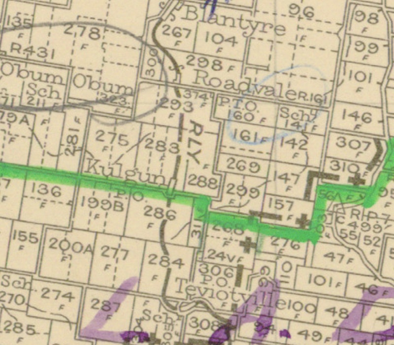
Segment from QLD 2 Mile map - 1955
Roadvale railway station
The locality takes its name from its former railway station which was named by the Queensland Railways Department in 1887, because of its location at a road junction. The Roadvale district was served by the Roadvale railway station on Roadvale Road. It was 28 miles 05 chains (45.2 km) from Ipswich at an elevation of 554 feet (169 m) [27.9164°S 152.6839°E].
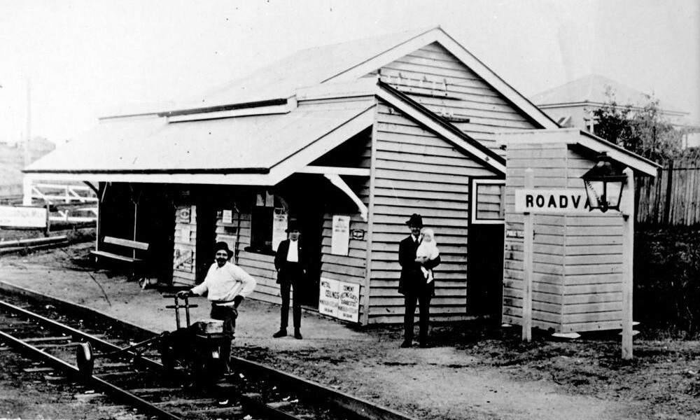
Roadvale railway station
Utilising Google Maps Lat/Long coordinate search, it places the Roadvale railway station along the Roadvale Road.
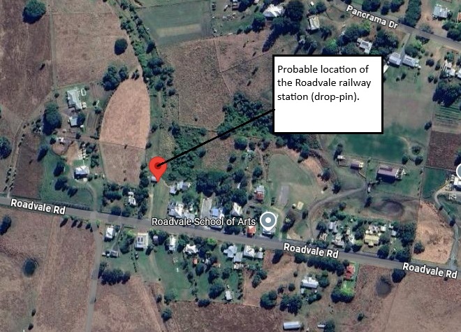
Probable Roadvale railway station location
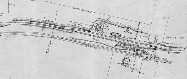
Roadvale railway station layout 1925 (QR drawing) [1]
Queensland Railways - Fassifern Branch - Roadvale Station (revised to May 1925)
Revision details from the Queensland Railways drawing as follows:
- 12-12-1950 - (49.5120) Approved to provide laundry to Station Master's House
- 21-10-1963 - (W.N. 43/63) Gates at Level Crossing normally set against rail traffic, now opened by train crews
- 02-03-1964 - (W.N. 10/64) Closed to Public Traffic from 01-07-1964
Kulgun railway station
The locality takes its name from its former railway station. The station was originally called Schneiders Road, but was changed by the Queensland Railway Department in 1908. Kulgun is an Aboriginal word meaning track or road. Kulgun was served by Kulgun railway station on Kulgun Road. It was 29 miles 07 chains (46.8 km) from Ipswich at an elevation of 570 feet (170 m) [27.9314°S 152.6831°E].
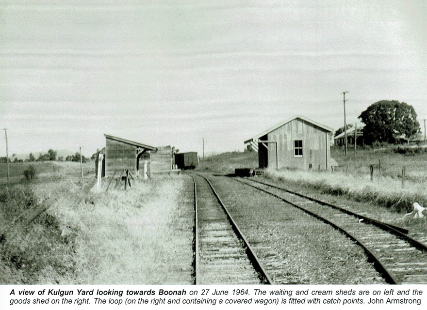
Kulgun railway station - 1964 [2]
Utilising Google Maps Lat/Long coordinate search, it places the Kulgun railway station along the Kulgun Road.
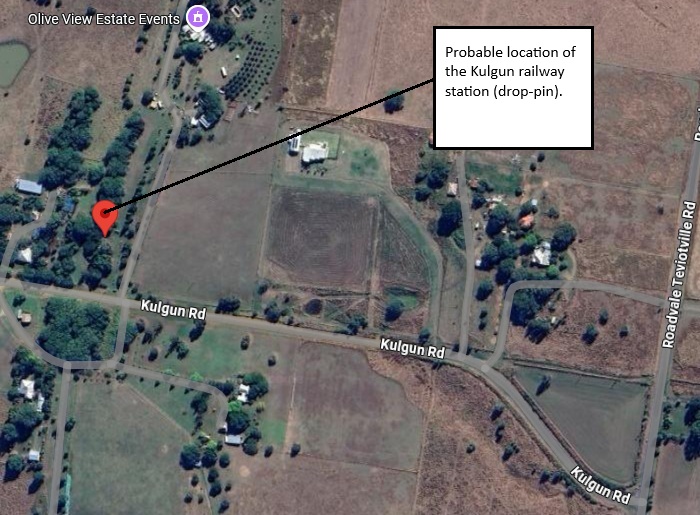
Probable Kulgun railway station location
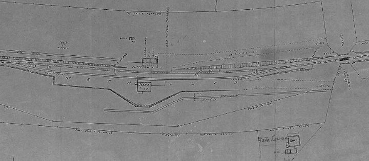
Kulgun railway station layout 1925 (QR drawing) [3]
Queensland Railways - Fassifern Branch - Kulgun Station (revised to May 1925)
Revision details from the Queensland Railways drawing as follows:
- 31-03-1948 - (47.2836) Additions to Gate House
- 22-09-1953 - (51.6376) Cream Shed (ex Hoya) re-erected here
- 21-10-1963 - (W.N. 43/63) Gates at Level Crossing normally set against rail traffic, now opened by train crews
- 02-03-1964 - (W.N. 10/64) Closed to Public Traffic from 01-07-1964
Teviotville railway station
The name Teviotville is derived from the name of its railway station, which was named by the Queensland Railway Department in 1887, which in turn was named after the major watercourse in the area, Teviot Brook. The brook in turn was named on 6 August 1828 by explorer Allan Cunningham after the River Teviot in Roxburghshire, Scotland. Teviotville was served by Teviotville railway station on Stanfield Road near the junction with Roadvale Teviotville Road. It was 30 miles 41 chains (49.1 km) from Ipswich at an elevation of 600 feet (180 m) [27.9472°S 152.6867°E].
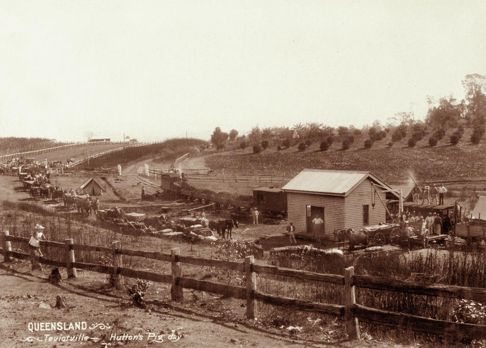
Teviotville railway station 1898
Utilising Google Maps Lat/Long coordinate search, it places the Teviotville railway station along Stanfield Road, near the junction with Roadvale Teviotville Road.
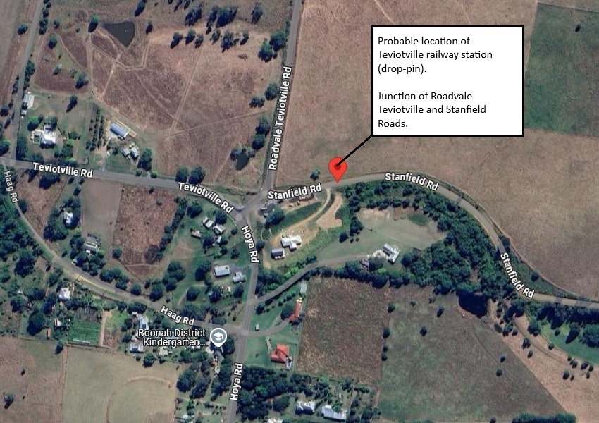
Probable Teviotville railway station location
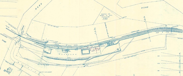
Teviotville railway station layout 1927 (QR drawing) [4]
Queensland Railways - Fassifern Branch - Teviotville Station (revised to June 1927)
Revision details from the Queensland Railways drawing as follows:
- 12-09-1928 - updated revision
- 23-01-1941 - (39.3951) Papers
- 01-08-1962 - (62.4892) Short deadend siding & loading bank removed
- [1] S00988-0001 Roadvale Station (May 1925) - (view the full version)
- [2] Look Out for Train: 7 - To The Scenic Rim 1 (page 55)
- [3] N00989-0001 Kulgun Station (May 1925) - (view the full version)
- [4] S00990-0001 Teviotville Station (June 1927) - (view the full version)