
Waraperta railway station
The locality, nestled in the Scenic Rim Region of Queensland and situated near Munbilla, was named by the Queensland Railways Department on 28 November 1914, with Waraperta as an Aboriginal word meaning tommahawk. It was located on Munbilla Road, 26 miles 56 chains (43.0 km) from Ipswich at an elevation of 247 feet (75 m) [27.90333°S 152.63278°E].
Utilising Google Maps Lat/Long coordinate search, it places the Waraperta railway station in a paddock north of Munbilla Road.
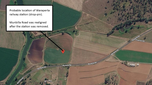
Probable Waraperta railway station location
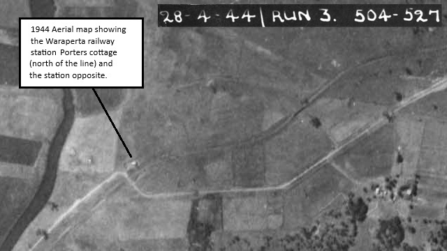
1944 Aerial map - Waraperta railway station location [1]
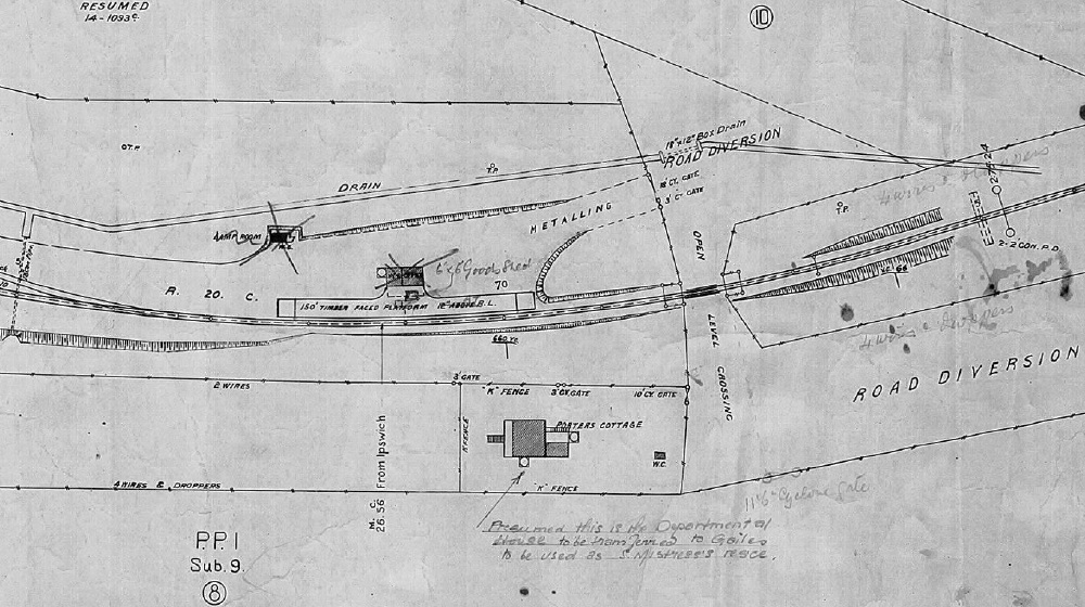
Waraperta railway station layout 1922 (QR drawing) [2]
Queensland Railways - Munbilla to Mt Edwards - Waraperta Station (revised to June 1922)
Revision details from the Queensland Railways drawing as follows:
- 18-07-1939 - (W.N.1/40) Station building to be removed and relocated to Munbilla
- 18-01-1940 - (39-2273) Lamproom and Closet removed
- 07-02-1940 - Goods Shed 6'x6' provided
- 10-11-1948 - (47.183) Platform at Road Level
- 01-09-1949 - (49-2927) Improvements to Departmental Residence
- 03-07-1950 - (49-4440) Approved to remove Siding (W.N.37/50) Siding Removed
- 12-09-1960 - (W.N. 37/60) Closed to Public Traffic from 01-11-1960
- 05-06-1961 - (61.4791) The Departmental house to be transferred to Gailes where it will be used as a Mistress Residence
Kalbar railway station
The town was once known as Fassifern Scrub and then Engelsburg after an early settler, storekeeper August Engels. The town was later renamed Kalbar in 1916 due to World War I anti-German sentiment.
The first stage of the Mount Edwards railway line reached the town on 17 April 1916, with the town being served by the Kalbar railway station. It was located on Railway Street, 29 miles 39 chains (47.5 km) from Ipswich at an elevation of 262 feet (80 m) [27.93924°S 152.62090°E].
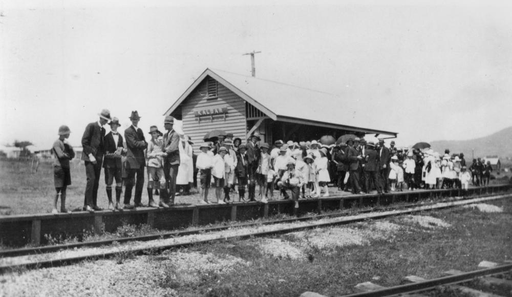
Kalbar railway station - 1925
Utilising Google Maps Lat/Long coordinate search, it places the Kalbar railway station at the western end of Railway Street.
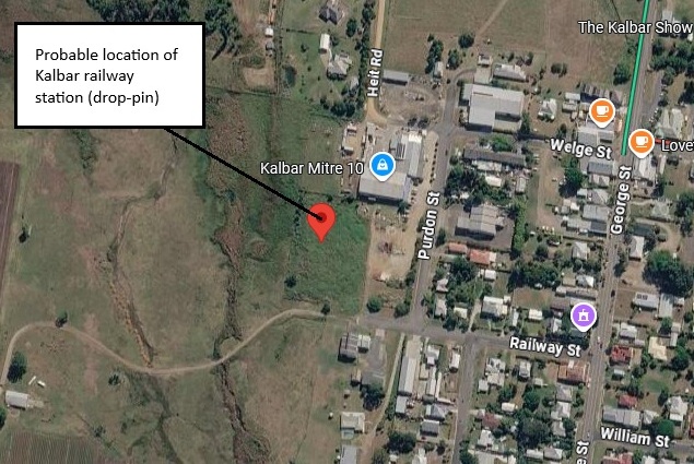
Probable Kalbar railway station location
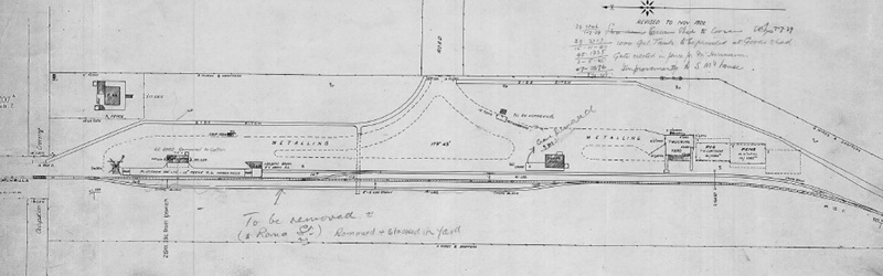
Kalbar railway station layout 1922 (QR drawing) [3]
Queensland Railways - Munbilla to Mt Edwards - Kalbar Station (revised to November 1922)
Revision details from the Queensland Railways drawing as follows:
- 01-07-1929 - (29.2146) Store Room Cream Shed to Cooran (07-07-1929)
- 15-11-1940 - (39.3717) 1000 Gallon Tank to be provided at Goods Shed
- 03-05-1945 - (45.1335) Gate errected in fence for Mr Herrmann
- 08-04-1948 - (47-2876) Improvements to Station Masters House
- 12-09-1960 - (W.N. 37/60) Closed to Public Traffic from 01-11-1960
- 01-08-1962 - (64.4674 M.1130) Approved to remove 12ton Cart Weighbridge to Proston (also M.5362 29-03-1965)
- late-1962 - (62.4952) removed the station building to Gatton
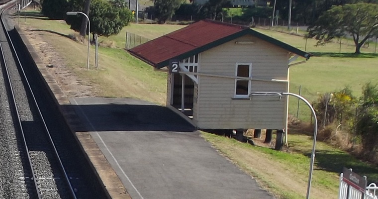
(possible) Kalbar railway station building (as platform 2 at Gatton) - 2013 [4]
Warumkarie railway station
Warumkarie railway station was a former railway stop on the historic Mount Edwards railway line in Kalbar, Queensland. It opened on October 7, 1922, and closed with the rest of the branch line in 1960. It was located 31 miles 34 chains (50.6 km) from Ipswich at an elevation of 308 feet (94 m) [27.95715°S 152.61082°E].
Utilising Google Maps Lat/Long coordinate search, it places the Warumkarie railway station in a paddock north of Warumkarie Road.
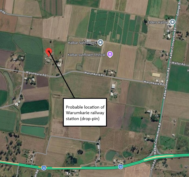
Probable Warumkarie railway station location
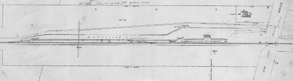
Warumkarie railway station layout 1925 (QR drawing) [5]
Queensland Railways - Munbilla to Mt Edwards - Waraperta Station (revised to June 1922)
Revision details from the Queensland Railways drawing as follows:
- 20-09-1933 - (32.1862) Station building to Newstead for Goods Office exchange (28-10-1933) Comm Plot. Small shelter shed provided
- 08-04-1948 - (47-2878) Bathroom to be provided at Fettler's Quarters
- 05-08-1948 - () Wash House provided at Fettler's Quarters
- 10-11-1948 - (47-183) Platform to Rail Level
- 04-09-1950 - (W.N. 36/50) Siding out of use, Points spiked over
- 06-07-1951 - (51-2693) Approved to remove loop and deadend siding
- 12-09-1960 - (W.N. 37/60) Closed to Public Traffic from 01-11-1960
Fassifern Valley railway station
The Fassifern Valley railway station was located on Charlwood Road (now Lake Moogerah Road). It was located 32 miles 60 chains (52.7 km) from Ipswich at an elevation of 295 feet (90 m) [27.97297°S 152.59979°E].
Utilising Google Maps Lat/Long coordinate search, it places the Fassifern Valley railway station Lake Moogerah Road (between Fassifern Valley Road and Peters Road).
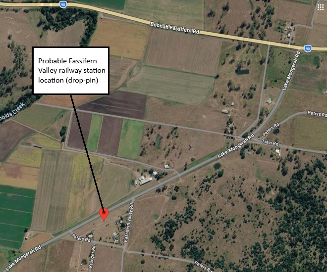
Probable Fassifern Valley railway station location
- [1] 504-527 - Map 1539-519 Run 3, 28-04-1944 Aerial Map Flinders Area
- [2] S05337-0001 Waraperta Station (June 1922) - (view the full version)
- [3] S05375-0001 Kalbar Station (November 1922) - (view the full version)
- [4] from Wikipedia - Gatton Railway Station (2013 image - Westbound view in July 2013 looking towards Toowoomba and Charleville)
- [5] S05338-0001 Warumkarie Station (May 1925) - (view the full version)