
In the map segment below (from the CAD map for Queensland Two Mile Series - 1955) the station locations for Hoya to Dugandan are detailed.
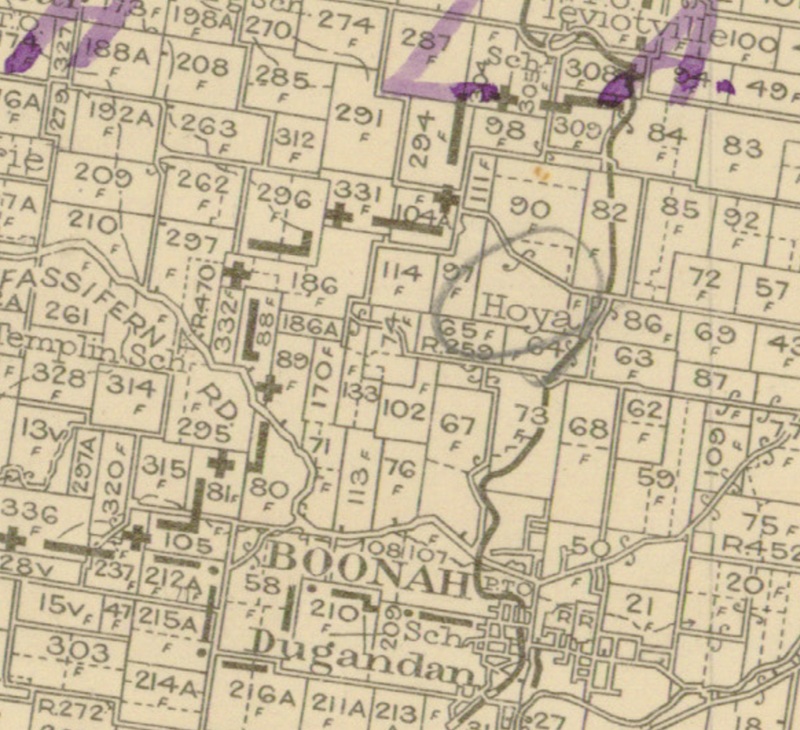
Segment from QLD 2 Mile map - 1955
Hoya railway station
Hoya was served by Hoya railway station on Hoya Road near the junction with Heise Road. It was 32 miles 45 chains (52.4 km) from Ipswich at an elevation of 427 feet (130 m) [27.9706°S 152.6891°E].
Utilising Google Maps Lat/Long coordinate search, it places the Hoya railway station along Hoya Road near the Junction with Heise Road.
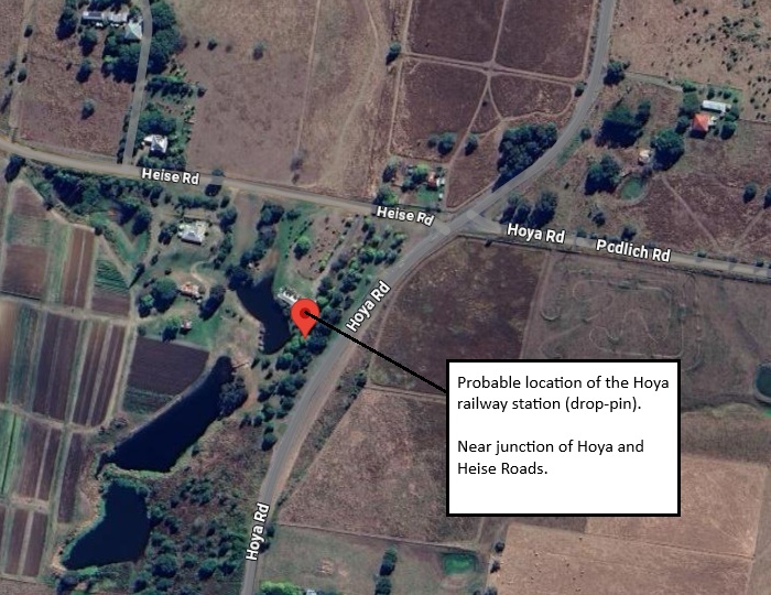
Probable Hoya railway station location
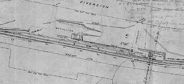
Hoya railway station layout 1916 (QR drawing) [1]
Queensland Railways - Fassifern Branch - Hoya Station (revised to November 1916)
Revision details from the Queensland Railways drawing as follows:
- 14-04-1930 - (29.3582) Improvements to Station Master's house (16-04-1930)
- 02-02-1937 - (37-833) Closed as Station/Gate and returned as a stop
- 15-02-1937 - (W.N. 8/37) Grids to be substituted for gates, worked as a D Stop
- 08-01-1940 - (39-2754) Goods shed to be removed
- 18-11-1949 - (49-3297) Siding points to be spiked over
- 26-12-1949 - (W.N. 52/49) Siding out of use, points spikde over
- 04-07-1950 - (49.3392) Approved to remove deadend siding
- 11-09-1950 - (W.N. 37/50) Siding removed
- 22-09-1953 - (51.6376) Cream Shed has been removed and re-erected at Kulgun
- 02-03-1964 - (W.N. 10/64) Closed to Public Traffic from 01-07-1964
Boonah railway station
In 1887, the railway line from Ipswich was extended to Blumbergville, with the name Boonah given to a rail siding located one stop before the terminus at the settlement of nearby Dugandan. The railway siding took its name from an Aboriginal word from the Yuggera and Yugumbir language groups meaning bloodwood tree (Corymbia gummifera) or Brigalow tree (Acacia harpophylla).
In 1888 Blumbergville was renamed as Boonah, and was served by Boonah railway station in Yeates Street. It was 34 miles 65 chains (56.0 km) from Ipswich at an elevation of 332 feet (101 m) [27.9969°S 152.6816°E].
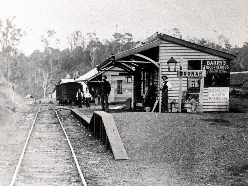
Boonah railway station 1915
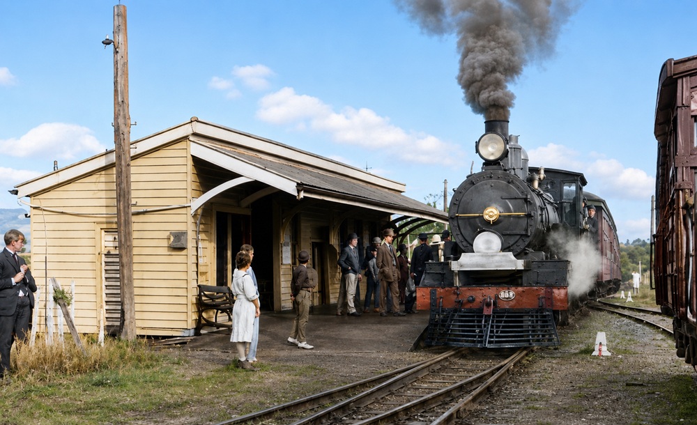
Boonah railway station - year unknown
Utilising Google Maps Lat/Long coordinate search, it places the Boonah railway station along Yeats Avenue near Parks Street.
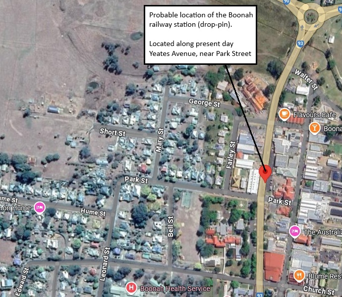
Probable Boonah railway station location
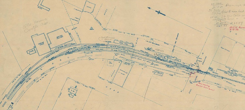
Boonah railway station layout 1934 (QR drawing) [2]
Queensland Railways - Fassifern Branch - Boonah Station (revised to March 1934)
Revision details from the Queensland Railways drawing as follows:
- 14-12-1935 - (35.2264)
- 08-06-1936 - (35-2264) Improving yard and fence at Station Master's residence (10-06-1936)
- 03-08-1936 - (35.1332) Residence for ??? Station Master
- 03-08-1938 - (37.1400) Completed
- 21-07-1939 - (39.3002) Drainage for Station Yard at Goods Shed (07-04-1939)
- 27-09-1940 - (39.3604) Approved to move back 10' E.L. Pole at O.L.C. to brang it inside new fenceline (08-10-1940)
- 25-10-1943 - (W.N. 43/43) 6 ton cart weighbridge removed, 10 ton cart weighbridge provided
- 06-07-1953 - (51.6817) M8359 Approved to raise platform
- 03-05-1955 - (54.4858) M968 Approved to remove 20 CWT crane and re-erect at Prairie
- 28-02-1957 - (W.N. 9/57) A 2 ton crane has been provided (no alteration)
- 02-10-1963 - (63.5712) Boonah Shire Council has rebuilt fence at Park Street, alignment
- 02-03-1964 - (W.N. 10/64) Closed to Public Traffic from 01-07-1964
Dugandan railway station
The name Dugandan is believed to be a Ugarapul word dugai/tugai meaning mountain spur place. Originally the name was used for a large pastoral run established in 1884, covering a much larger area than the current locality from Boonah to Mount Joyce.
Dugandan was served by Dugandan railway station (opened on 12 September 1887) along Charles Street. It was 35 miles 28 chains (56.9 km) from Ipswich at an elevation of 299 feet (91 m) [28.0039°S 152.6777°E].
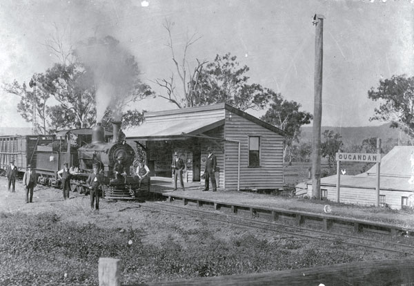
Dugandan railway station 1930
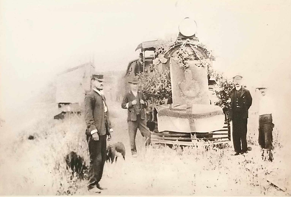
Dugandan railway station 1887
Utilising Google Maps Lat/Long coordinate search, it places the Dugandan railway station along Charles Street.
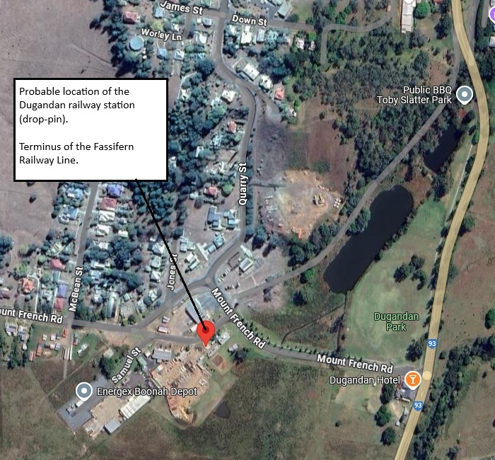
Probable Dugandan railway station location
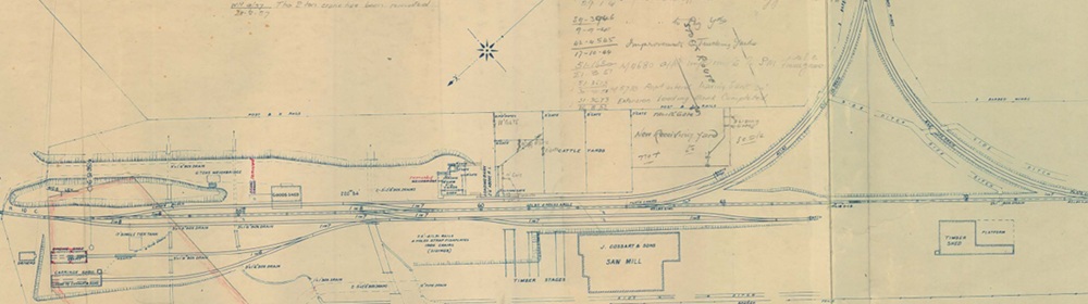
Dugandan railway station layout 1934 (QR drawing) [3]
Queensland Railways - Fassifern Branch - Dugandan Station (revised to March 1934)
Revision details from the Queensland Railways drawing as follows:
- 13-07-1934 - (32.1617) Papers
- 29-01-1941 - (39.3946) Improvements effected to trucking yards (17-02-1941)
- 09-09-1941 - (39.3946) Improvements effected to pig yards
- 17-10-1944 - (42.4545) Improvemnts for trucking yards
- 21-03-1951 - (51-1630) M4680 Approved improvements to Station Master' house
- 30-10-1951 - (51-3673) M5733 Approved extend loading bank 20'
- 26-08-1952 - (51.3673) Extension bank completed
- 28-02-1957 - (W.N. 9/57) The 2 ton crane has been removed
- 30-07-1959 - (57.2546) An additional gate has been provided in the Trucking Yards (print submitted not to scale)
- 09-11-1959 - (W.N. 46/59) The 6 ton weighbridge has been removed
- 08-01-1963 - (63.5697) Approved to remove engine shed
- 02-03-1964 - (W.N. 10/64) Closed to Public Traffic from 01-07-1964
- 18-09-1986 - (Stn 462-7) Area edged red sold to SEQEB
- 08-06-1988 - (Stn 462-7) Land sold in Charles Street to RH & WC Brain
- 01-08-1988 - (Stn 462-7) Vacant land sold - Lot 4 on RP211995 Charles Street to SEQEB
- [1] S00991-0001 Hoya Station (November 1916) - (view the full version)
- [2] S00992-0001 Boonah Station (March 1934) - (view the full version)
- [3] S00993-0001 Dugandan Station (March 1934) - (view the full version)