
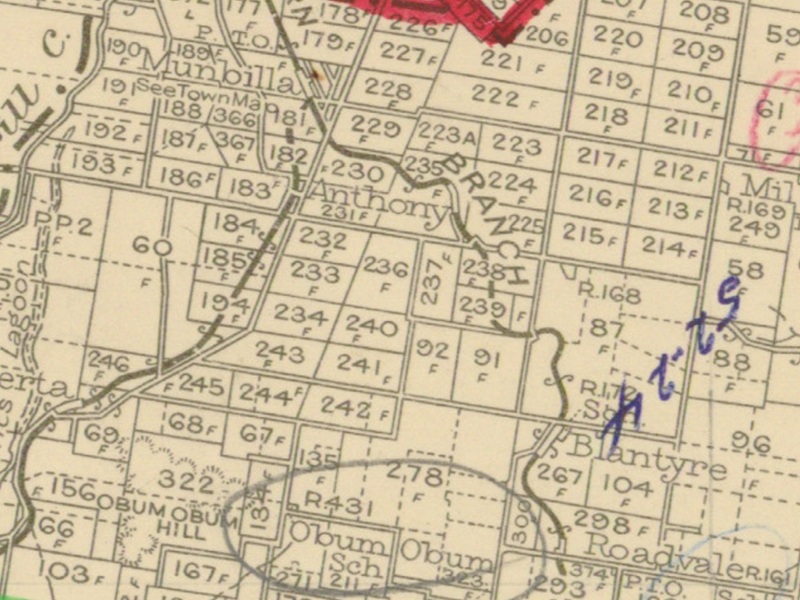
In the map segment below (from the CAD map for Queensland Two Mile Series - 1955) the station locations for Munbilla to Blantyre are detailed.
Segment from QLD 2 Mile map - 1955
Munbilla railway station
The suburb takes its name from the former Munbilla railway station, whose name was created in 1886 by the Queensland Railways Department using the Yuggera words mun (meaning much) and billa (meaning water) to mean a large lagoon.
Munbilla was served by the Munbilla railway station at the end of MacFarlane Road (at the time). It was 23 miles 64 chains (38.3 km) from Ipswich at an elevation of 278 feet (85 m) [27.873611°S 152.657778°E]. Since the closure of the railway station, MacFarlane Road was extended along the old railway line and passes Hall Road and meets with Redhill Road.
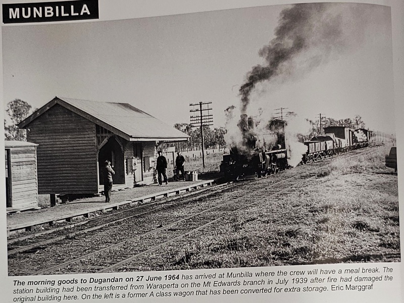
Munbilla railway station - 1964 [1]
Utilising Google Maps Lat/Long coordinate search, it places the Munbilla railway station at the end of MacFarlane Road at the Junction with MacLean Road.
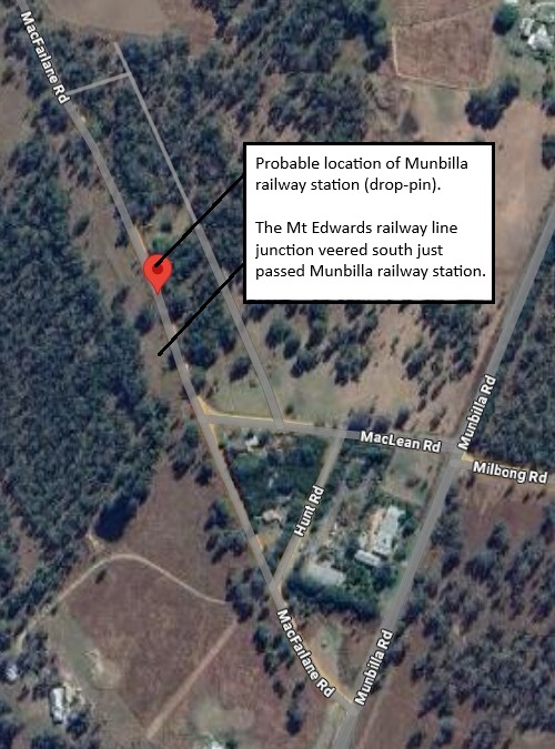
Probable Munbilla railway station location
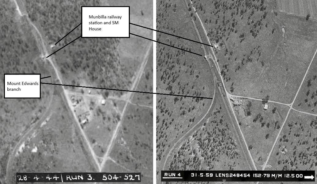
1944 and 1959 Aerial maps - Munbilla railway station location [2] [3]

Munbilla railway station layout 1927 (QR drawing) [4]
Queensland Railways - Fassifern Branch - Munbilla Station (revised to June 1927)
Revision details from the Queensland Railways drawing as follows:
- 10-09-1928 - removal of cream shed
- 04-11-1929 - (W.N. 45/29) Up and Down Signals removed (15-11-1929)
- 18-07-1939 - (39-1972) Spare Station from Waraperta to be erected
- 30-06-1941 - (W.N. 27/41) 6 Ton Weighbridge removed
- 27-05-1948 - (47-3541) Improvements to Station Masters residence
- 14-09-1949 - (49-9120) Fence erected
- 16-01-1950 - (49-9120) Fence erected
- 19-06-1951 - (51 8196) Fencing re-arranged and sanitary facilities removed to new site
- 21-08-1951 - (51.896) Alteration to position of wire fence/gate near lever signals
- 12-09-1960 - (W.N. 37/60) Closed to Public Traffic from 01-11-1960
- 02-03-1964 - (W.N. 10/64) Closed to Public Traffic from 01-07-1964
Mount Edwards branch line
The Mount Edwards branch line branched off from the Fassifern line immediately south of the Munbilla railway station [Junction 27.87392°S 152.65792°E]. The Mount Edwards line opened to Kalbar on 17 April 1916 and to Mount Edwards on 7 October 1922. The Mount Edwards line closed in 1960.
Anthony railway station
The locality takes its name from the Anthony railway station, which in turn was named circa 1887 after a local resident. It was located near Anthony Road between Brooks and Ferrar Roads 25 miles 12 chains (40.5 km) from Ipswich at an elevation of 398 feet (121 m) [27.8836°S 152.6731°E].
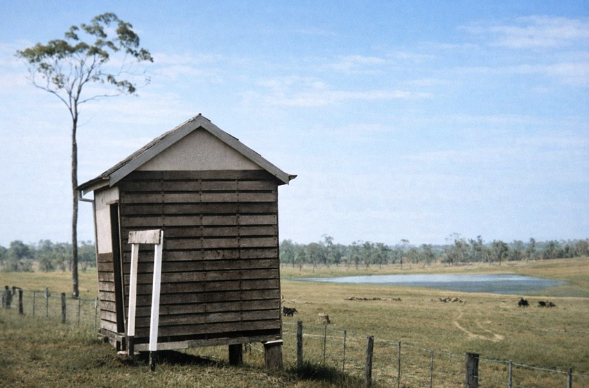
Anthony railway station - 1960
Utilising Google Maps Lat/Long coordinate search, it places the Anthony railway station on Anthony Road, between Brooks and Ferrar Roads.
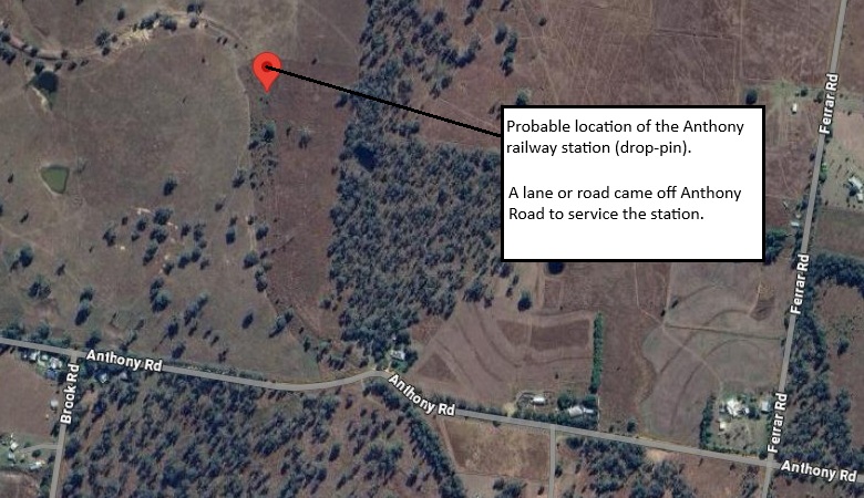
Probable Anthony railway station location
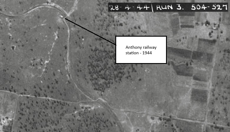
1944 Aerial map - Anthony railway station location [2]
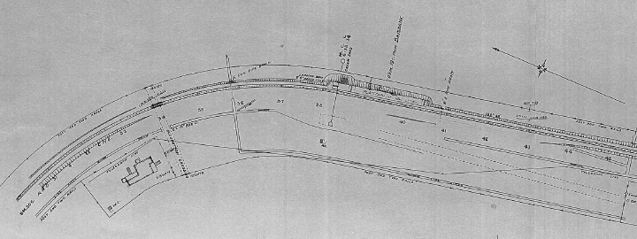
Anthony railway station layout 1925 (QR drawing) [5]
Queensland Railways - Southern & Western - Fassifern Branch - Anthony Station (revised to May 1925)
Revision details from the Queensland Railways drawing as follows:
- 29-05-1951 - (51 1335) Papers
- 02-03-1964 - (W.N. 10/64) Closed to Public Traffic from 01-07-1964
Blantyre railway station
The name Blantyre was originally a property name given by James Moffatt, believed to be after a Scottish town of Blantyre. Later, the name was used for Blantyre railway station. It was located near Blantyre Road and Greer Road, serving the town of Blantyre. It was 27 miles 14 chains (43.7 km) from Ipswich at an elevation of 543 feet (166 m) [27.9056°S 152.6832°E].
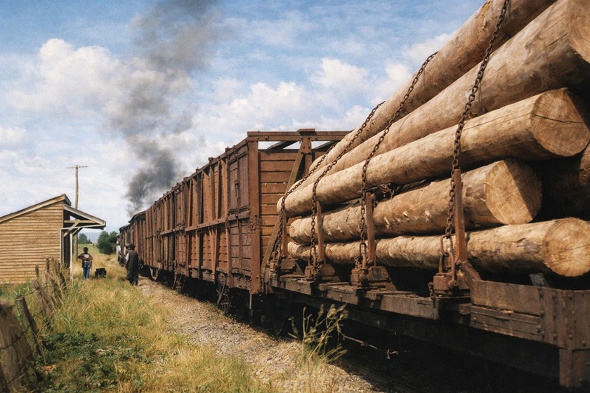
Blantyre railway station - 1964
Utilising Google Maps Lat/Long coordinate search, it places the Blantyre railway station on Blantyre Road, near the junction to Greer Road.
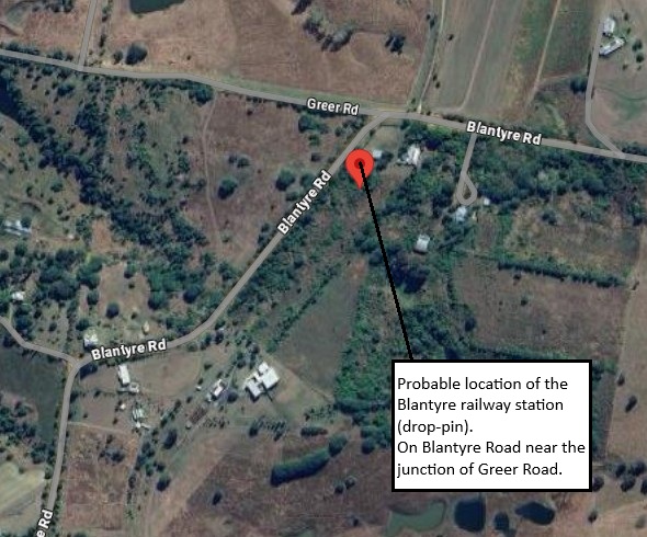
Probable Blantyre railway station location
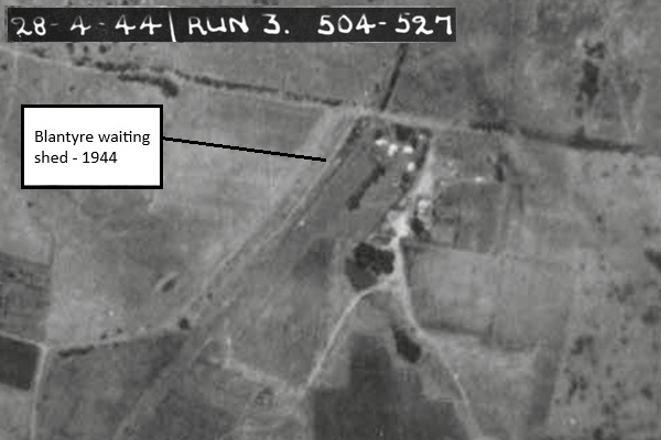
1944 Aerial map - Blantyre railway station location [2]
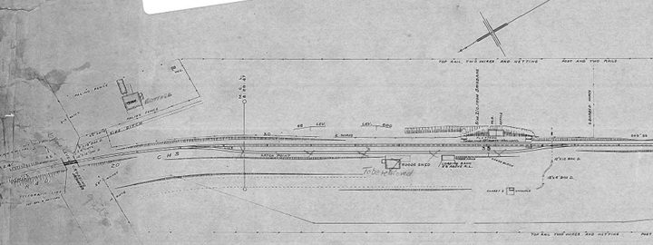
Blantyre railway station layout 1925 (QR drawing) [6]
Queensland Railways - Fassifern Branch - Blantyre Station (revised to May 1925)
Revision details from the Queensland Railways drawing as follows:
- 13-02-1930 - (29.3328) Grids added and gates removed
- 21-04-1930 - (W.N 17/30) Closed as Gate (28-05-1930)
- 25-01-1933 - (32.1707) 15" Concrete Pipe at 8M 45C to replace 12" x 12" Box Drain (11-04-1933)
- 03-12-1936 - (35-1920) Platform reduced to Rail Level
- 01-10-1940 - (39-1089) Spare Goods Shed to be removed to Mayne (09-10-1940)
- 25-08-1950 - (49-4629) after remove loop Siding - points to be spiked over meanwhile
- 18-09-1950 - (W.N 38/50) Siding out of use, points spiked over
- 05-02-1951 - (W.N. 6/51) Siding and Side Loading Bank
- 29-09-1951 - (51-3470) Siding has been removed
- 02-03-1964 - (W.N. 10/64) Closed to Public Traffic from 01-07-1964
- [1] Look Out for Train: 7 - To The Scenic Rim 1 (page 47) - colourised version
- [2] 504-527 - Map 1539-519 Run 3, 28-04-1944 Aerial Map Flinders Area
- [3] Q890-100 Run 4, 31/05/1959 Aerial Map, (QLD) Dept. of Natural Resources and Water
- [4] S00985-0001 Munbilla Station (June 1927) - (view the full version)
- [5] S00986-0001 Anthony Station (May 1925) - (view the full version)
- [6] S00987-0001 Blantyre Station (May 1925) - (view the full version)